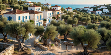
1. Route Topology & Ancient Mule Paths (Kalderimia)
Unlike the arid coastal beaches, central Naxos is a lush, mountainous bastion crowned by Mount Zas (1,004m). For thousands of years, trade across the island was conducted along paved marble and schist donkey paths called kalderimia.
This guide maps the 7 connected trails linking the inland marble villages: Filoti, Chalki, Apeiranthos, Moni, and Kinidaros.
2. Stage Breakdown & Waypoints
| Trail Leg | Corridor | Distance | Surface |
|---|---|---|---|
| Leg 01 | Chalki ➔ Panagia Drosiani ➔ Moni | 6.4 km | Paved Marble & Olive Dirt Path |
| Leg 02 | Moni ➔ Apeiranthos (Marble Village) | 7.2 km | Steep Schist Donkey Steps (+380m) |
| Leg 03 | Apeiranthos ➔ Danakos ➔ Agia Marina | 8.1 km | Spring Valley Trail |
| Leg 04 | Agia Marina ➔ Mount Zas Summit ➔ Filoti | 9.5 km | Limestone Scree & Ancient Ridge |
| Leg 05 | Filoti ➔ Chalki (Byzantine Valley) | 5.8 km | Flat Ancient Olive Terraces |
3. Water Points & Resupply Ethics
Central Naxos features year-round natural mountain springs (Vrysi) in every village square, meaning you never need to purchase single-use bottled water. Pack a 1-liter reusable titanium or insulated flask.